
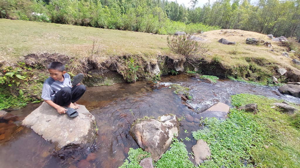
Lembah Ramma is one of the most beautiful mountain destinations in Gowa Regency, South Sulawesi, Indonesia. Located on the slopes of Mount Bawakaraeng, this spectacular valley offers a combination of green grasslands, crystal-clear mountain streams, moss-covered forests, natural lakes, and dramatic mountain landscapes. For nature lovers, photographers, campers, and hiking enthusiasts, Lembah Ramma is an unforgettable destination.
One of the most popular ways to reach this valley is through the Lembanna hiking trail in the Malino highlands. The journey takes hikers through pine forests, small rivers, dense vegetation, steep ridges, and breathtaking viewpoints before finally descending into the beautiful valley.
Located approximately two hours by road from Makassar, Lembah Ramma is an attractive destination for visitors looking for a mountain adventure without travelling too far from the provincial capital.
Where Is Lembah Ramma?
Lembah Ramma is situated in the mountainous area of Gowa Regency, South Sulawesi, at an elevation of approximately 1,675 metres above sea level. The valley lies beneath the impressive slopes of Mount Bawakaraeng and forms part of the wider mountain landscape of the Lompobattang range.
The area is known for its cool temperatures, fresh mountain air, and spectacular natural scenery. Unlike conventional tourist attractions, Lembah Ramma requires visitors to hike several kilometres to reach its main camping area.
There are two commonly used hiking routes to reach Lembah Ramma:
- Lembanna Route: A longer hiking trail that takes approximately 5–6 hours at a relaxed walking pace.
- Panaikang Route: A shorter alternative that generally takes around 2 hours, depending on weather conditions, fitness levels, and trail conditions.
Both routes offer different experiences. However, the Lembanna route is particularly attractive for hikers who enjoy exploring forests, mountain streams, and scenic ridgelines.
Hiking Distance and Duration via Lembanna
The hiking distance from the Lembanna registration area to Lembah Ramma is approximately 6.3 kilometres.
- Starting point: Lembanna Registration Post
- Destination: Lembah Ramma
- Total distance: Approximately 6.3 km
- Estimated hiking duration: 5–6 hours at a relaxed pace
- Starting elevation: Approximately 1,500 metres
- Highest point along the described route: Talung Ridge, approximately 1,810 metres
- Destination elevation: Approximately 1,675 metres
The journey is not simply a continuous uphill climb. Hikers will encounter a combination of ascents and descents, river crossings, forest trails, and rocky sections.
One of the highlights is Talung Ridge, where visitors can enjoy panoramic views of Mount Bawakaraeng, the Lompobattang mountain range, and the surrounding valleys.
Getting to Lembanna from Makassar
The journey begins in Makassar, the capital city of South Sulawesi.
From Makassar, visitors can travel by private car or motorcycle towards Malino, a popular mountain destination in Gowa Regency. The journey generally takes around two hours, although travel time depends on traffic and road conditions.
Lembanna is located in the highland area near Malino. Before starting the hike, visitors should make sure they have sufficient food, drinking water, suitable footwear, and personal hiking equipment.
The starting point is a pine forest camping area near a local cemetery and agricultural land belonging to nearby residents.
This location serves as the registration point for hikers heading towards Lembah Ramma and Mount Bawakaraeng.
Complete Hiking Route to Lembah Ramma via Lembanna
The following is a description of the main hiking checkpoints along the Lembanna route.
1. Lembanna Registration Post
The journey starts at the Lembanna Registration Post, located in a beautiful pine forest.
- Coordinates: -5.25825, 119.90808
- Elevation: Approximately 1,500 metres above sea level
- Distance from Malino: Approximately 9 kilometres
The registration area is surrounded by tall pine trees, creating a cool and peaceful atmosphere. It has also become a popular camping destination for visitors escaping the busy atmosphere of Makassar and other urban areas.
Before entering the hiking trail, visitors must register with the local management team and follow the applicable entry procedures.
The original registration system described by local hikers included an entrance fee of IDR 10,000 per person and the deposit of an identification document by the group leader. However, visitors should confirm current fees and registration requirements before travelling.
From this point, the trail passes through the pine forest before reaching the first major junction, where hikers must follow the direction towards Lembah Ramma rather than continuing along the Mount Bawakaraeng summit trail.
2. Post 1 – Bawakaraeng Hiking Trail
Post 1 is the first major checkpoint along the route.
- Coordinates: -5.26868, 119.91226
- Elevation: Approximately 1,719 metres
- Distance from Registration Post: 1,760 metres
The trail from the registration area to Post 1 is approximately 1.76 kilometres long.
This section is relatively manageable compared with some of the later sections. The path consists of rocky ground, soil, and small streams flowing alongside the hiking trail.
At a relaxed walking pace, hikers may need approximately one hour to reach this checkpoint.
Post 1 is an open area where visitors can take a short break, drink water, and prepare for the next section.
There is also an important trail junction here. The route on one side continues towards Mount Bawakaraeng, while the other leads towards Lembah Ramma.
Hikers heading to the valley must make sure they follow the correct direction.
3. Binanga 1 – The First Mountain Water Source
- Coordinates: -5.27344, 119.91102
- Elevation: Approximately 1,730 metres
- Distance from Post 1: 596 metres
After leaving Post 1, the trail gradually descends towards Binanga 1.
This checkpoint is identified by a small mountain stream that has been partially dammed, creating a natural-looking pool.
Binanga 1 is an important resting location because hikers can find a water source here.
The surrounding landscape is green and refreshing, making it a suitable place to take a break before continuing deeper into the forest.
The terrain is generally gentle, although some sections may become slippery after rainfall.
4. Binanga 2 – Entering the Mossy Forest
- Coordinates: -5.27819, 119.91311
- Elevation: Approximately 1,770 metres
- Distance from Binanga 1: 636 metres
From Binanga 1, the trail begins with a gradual climb before entering an area of dense vegetation.
This section is particularly interesting because hikers start experiencing the atmosphere of a tropical mountain forest.
The trees, moss-covered surfaces, and damp surroundings create a completely different environment from the open pine forest near the starting point.
After passing through the forest, the trail becomes relatively flat and then descends towards the second stream, known as Binanga 2.
The sound of flowing water provides a peaceful atmosphere along this section.
5. Binanga 3 – A Series of Small Mountain Streams
- Coordinates: -5.28261, 119.91266
- Elevation: Approximately 1,787 metres
- Distance from Binanga 2: 568 metres
The journey from Binanga 2 to Binanga 3 involves another gradual ascent through mossy forest vegetation.
Some sections are covered by dense trees, while other areas have shorter vegetation and more open surroundings.
Along this section, hikers will cross two small streams before reaching Binanga 3.
The changing landscape makes the trail more interesting. Visitors can experience different forest environments within a relatively short distance.
As with other water crossings, it is important to walk carefully, particularly when the rocks are wet.
6. Binanga 4 – The Last Water Source Before Talung
- Coordinates: -5.29066, 119.90841
- Elevation: Approximately 1,775 metres
- Distance from Binanga 3: 1,200 metres
The trail becomes more challenging after leaving Binanga 3.
Hikers will encounter a longer uphill section through dense forest vegetation before reaching the top of a hill.
After crossing the ridge, the path descends quite steeply. This section contains exposed roots, rocks, and rattan plants along the trail.
Extra caution is necessary because some parts can be slippery and difficult to navigate.
At the bottom of the descent, hikers will find a small stream marking Binanga 4.
This checkpoint is particularly important for anyone planning to camp overnight at Talung Ridge.
Binanga 4 is the last known water source before reaching Talung along this route. Therefore, hikers intending to stay overnight at Talung should collect enough water for drinking, cooking, and other essential needs.
Those continuing directly to Lembah Ramma have access to additional water sources in the valley.
7. Talung Ridge – The Best Panoramic Viewpoint
- Coordinates: -5.29427, 119.90905
- Elevation: Approximately 1,810 metres
- Distance from Binanga 4: 434 metres
Talung is one of the most spectacular locations along the Lembanna hiking route.
After leaving Binanga 4, hikers face a steep rocky ascent leading towards the mountain ridge.
The climb requires additional energy, especially for visitors carrying heavy backpacks.
Once reaching the top, the trail follows an open ridgeline towards Talung.
The viewpoint offers magnificent scenery because the surrounding landscape is relatively unobstructed.
From Talung, visitors can admire the dramatic cliffs of Mount Bawakaraeng and the wider Lompobattang mountain range.
One of the most impressive sights is the enormous landslide scar on the slopes of Mount Bawakaraeng, which forms a distinctive feature of the mountain landscape.
Far below, several mountain lakes can be seen surrounded by green vegetation.
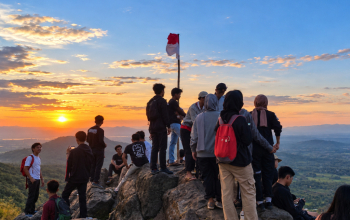
Talung is also an excellent place to enjoy sunset. As the sky changes colour, the surrounding mountains create an unforgettable natural panorama.
At night, when weather conditions are clear, visitors may even see the distant lights of Gowa Regency and Makassar.
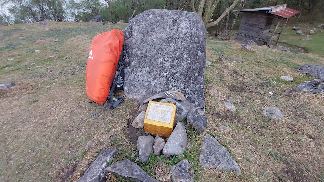
There is also a small shelter traditionally used by cattle herders in the area.
Talung is an important meeting point because it also functions as Post 5 along the Panaikang route to Lembah Ramma.
The area includes a memorial monument dedicated to Abd. Rahman Exel, a hiker who died at Talung in 2001. This memorial reminds visitors that mountain activities require proper preparation, discipline, and respect for nature.
8. Lembah Ramma – The Final Destination
- Coordinates: -5.29605, 119.91549
- Elevation: Approximately 1,675 metres
- Distance from Talung: Approximately 1.2 km via the Sapi trail or 800 metres via the Naga trail
After enjoying the views from Talung, the journey continues downhill towards Lembah Ramma.
There are two commonly described paths connecting Talung to the valley: the Sapi trail, approximately 1.2 kilometres long, and the shorter Naga trail, approximately 800 metres long.
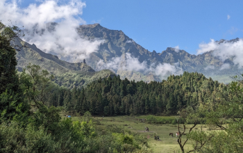
The descent eventually reveals a wide green valley surrounded by dramatic mountain cliffs.
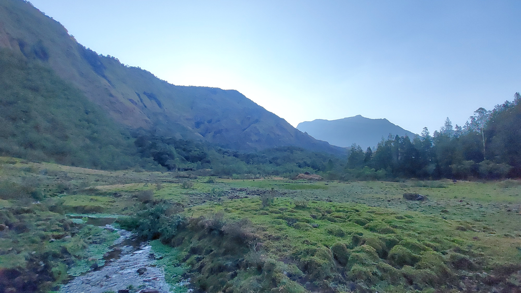
Lembah Ramma is characterised by extensive grasslands, clear mountain streams, small lakes, and beautiful natural scenery.
A small river flows through the valley, providing an important water source for visitors and the surrounding ecosystem.
One of the most distinctive features of this destination is the presence of free-roaming cattle and horses across the grasslands.
The animals add a unique atmosphere to the landscape, making the valley look like a remote mountain paradise.
The surrounding cliffs of Mount Bawakaraeng create a dramatic backdrop, while the historic landslide landscape extends towards the direction of Bili-Bili Reservoir.
For many hikers, arriving at Lembah Ramma after several hours of walking is the most rewarding moment of the entire journey.
Activities to Enjoy in Lembah Ramma
Lembah Ramma is more than just a hiking destination. Its natural landscape offers many opportunities for outdoor activities.
1. Camping
Camping is one of the most popular activities in Lembah Ramma. The wide grassland provides several locations where visitors can pitch their tents while enjoying the surrounding mountain scenery.
2. Photography
The combination of mountain cliffs, rivers, green grasslands, and morning mist makes Lembah Ramma an excellent photography destination.
Sunrise and sunset are particularly attractive moments for landscape photography.
3. Exploring Mountain Lakes
Several natural lakes are located around the valley. Exploring these areas requires additional time and careful route planning.
4. Outdoor Education
Lembah Ramma is frequently used for outdoor activities, nature introduction programmes, hiking education, and basic mountain training.
It is also a destination for environmental organisations and outdoor communities conducting educational activities.
5. Relaxing in Nature
For visitors who simply want to escape city life, sitting beside a mountain stream and enjoying the cool mountain air can be an unforgettable experience.
How Many Days Should You Spend in Lembah Ramma?
A one-night camping trip is suitable for visitors who want to experience the main valley, enjoy the scenery, and return through the same route.
However, visitors who want to explore the surrounding lakes, waterfalls, landslide areas, and other natural attractions should consider spending two or three days in the area.
Lembah Ramma is relatively extensive, and exploring its surrounding landscapes requires more time than simply reaching the main camping ground.
For photographers and outdoor enthusiasts, spending additional time allows them to discover more interesting viewpoints and capture different atmospheric conditions.
Essential Hiking Preparation and Safety Tips
Although the Lembanna route is popular among local hikers, it should not be underestimated.
The trail contains steep climbs, rocky sections, slippery streams, dense vegetation, and exposed ridgelines.
Before starting the journey, consider the following recommendations:
- Wear proper hiking shoes with good grip.
- Bring sufficient drinking water, especially if planning to camp at Talung.
- Carry a waterproof jacket because mountain weather can change quickly.
- Bring a headlamp or flashlight for nighttime activities.
- Prepare sufficient food and personal medication.
- Carry a first-aid kit and emergency equipment.
- Download offline maps and save important trail coordinates.
- Check weather forecasts and local trail conditions before departure.
- Never hike alone if you are unfamiliar with the route.
- Inform your family or friends about your hiking itinerary.
Mobile phone reception may vary along the trail. Therefore, visitors should not depend entirely on mobile communication.
It is also important to respect the environment. Take all rubbish back with you, avoid disturbing wildlife, and do not damage plants or natural water sources.
Best Time to Visit Lembah Ramma
The best time to hike to Lembah Ramma is generally during favourable weather conditions, particularly when rainfall is relatively low.
Dry conditions make the trail easier to navigate and improve visibility from Talung Ridge.
However, mountain weather is unpredictable. Even during the dry season, fog, strong winds, and sudden rain can occur.
Visitors should always check local weather information and seek updates from experienced local hikers before departure.
Weekends and public holidays are generally busier, with outdoor communities and camping groups visiting the valley.
Those seeking a quieter experience may prefer hiking on weekdays, subject to local access arrangements.
Final Thoughts: Discover the Beauty of Lembah Ramma, South Sulawesi
Lembah Ramma is one of South Sulawesi’s remarkable natural destinations, offering an authentic mountain adventure within relatively easy reach of Makassar.
The Lembanna hiking route is particularly rewarding because it combines several different landscapes in one journey. From the peaceful pine forest at the registration area to the moss-covered forests, mountain streams, steep ridges, and spectacular Talung viewpoint, every section offers something different.
The final descent into Lembah Ramma reveals a beautiful green valley beneath the impressive cliffs of Mount Bawakaraeng.
Whether you are an experienced hiker, a camping enthusiast, a landscape photographer, or someone looking for a refreshing escape from everyday life, Lembah Ramma deserves a place on your South Sulawesi travel itinerary.
It is not simply about reaching the destination. The real experience lies in every step of the journey, the changing mountain scenery, the sound of flowing water, and the peaceful atmosphere of nature.
Lembah Ramma is a place where the mountains, forests, rivers, and open grasslands come together to create one unforgettable adventure in South Sulawesi, Indonesia.

Maybe you are interested in reading the following article:
Lembah Ramma Hiking Trail via Lembanna, Malino: A Complete Guide to Exploring South Sulawesi’s Mountain Paradise
Lembah Ramma is one of the most beautiful mountain destinations in Gowa Regency, South Sulawesi, Indonesia. Located on the slopes of Mount Bawakaraeng, this spectacular valley offers a combination of green grasslands, crystal-clear mountain streams, moss-covered forests, natural lakes, and dramatic mountain landscapes. For nature lovers, photographers, campe... read more
How to Visit Lembah Ramma from Makassar: Transport, Guide, Camping, and All-Inclusive Costs
Lembah Ramma is one of the most beautiful mountain destinations in Gowa Regency, South Sulawesi, Indonesia. Surrounded by green hills, mountain landscapes, open grasslands, and peaceful natural scenery, this hidden valley is an excellent destination for travelers who want to experience trekking and camping away from the busy atmosphere of the city. For trave... read more
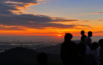
Bulusaukang Mountain: An Easy Hiking Adventure Near Makassar, South Sulawesi – 332 MASL
Looking for a short hiking adventure near Makassar without having to climb a high mountain or spend an entire day on the trail? Mount Bulusaukang in Maros, South Sulawesi, is an interesting destination for travelers who want to enjoy nature, fresh mountain air, beautiful landscapes, and a relaxing outdoor experience. Standing at approximately 332 meters... read more

Contact Us
If you have any questions, please contact us.
-
Hotline
+62881080121080 -
Whatsapp
+62881080121080 -
Email
amiruddinemail@gmail.com


No comment yet