
Mount Bulusaraung is one of the most fascinating hiking destinations in South Sulawesi, Indonesia. Standing at approximately 1,353 meters above sea level (MASL), this limestone mountain offers a unique combination of challenging hiking trails, dramatic karst landscapes, tropical forests, and spectacular panoramic views.
Located in Tompobulu Village, Balocci District, Pangkajene and Islands Regency (Pangkep), Mount Bulusaraung is an excellent destination for nature enthusiasts, adventure travelers, photographers, and hikers looking to explore the natural beauty of South Sulawesi.
Unlike volcanic mountains, Bulusaraung is characterized by limestone formations, steep rocky slopes, and distinctive karst topography. Its natural environment forms part of the famous Maros-Pangkep karst landscape, one of Indonesia’s most remarkable geological areas.
For travelers visiting Makassar, Mount Bulusaraung offers an opportunity to experience a different side of South Sulawesi beyond its beaches, traditional villages, and cultural attractions.
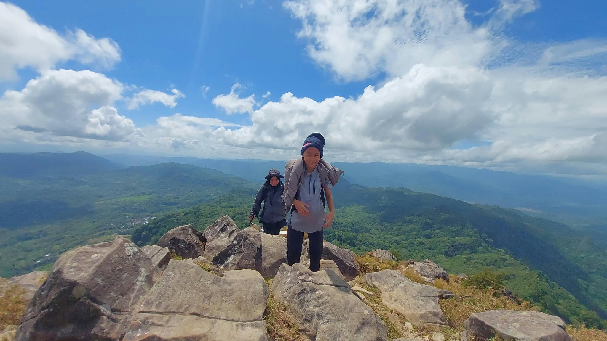
1. Where Is Mount Bulusaraung Located?
Mount Bulusaraung is situated in Tompobulu Village, Balocci District, Pangkajene and Islands Regency, South Sulawesi, Indonesia.
The mountain is part of Bantimurung Bulusaraung National Park, a protected conservation area famous for its limestone mountains, caves, waterfalls, tropical forests, and diverse wildlife.
Its geographical position makes Mount Bulusaraung accessible from Makassar, the capital of South Sulawesi. The journey from Makassar generally takes around two to three hours by private vehicle, depending on traffic conditions, weather, and road conditions.
The surrounding area is also home to traditional villages and beautiful natural scenery. Along the journey, visitors can enjoy views of rural settlements, agricultural landscapes, limestone hills, and the distinctive karst formations of Maros and Pangkep.
Because of its location within a national park, visitors should respect conservation regulations and follow the instructions of park officers and local authorities.
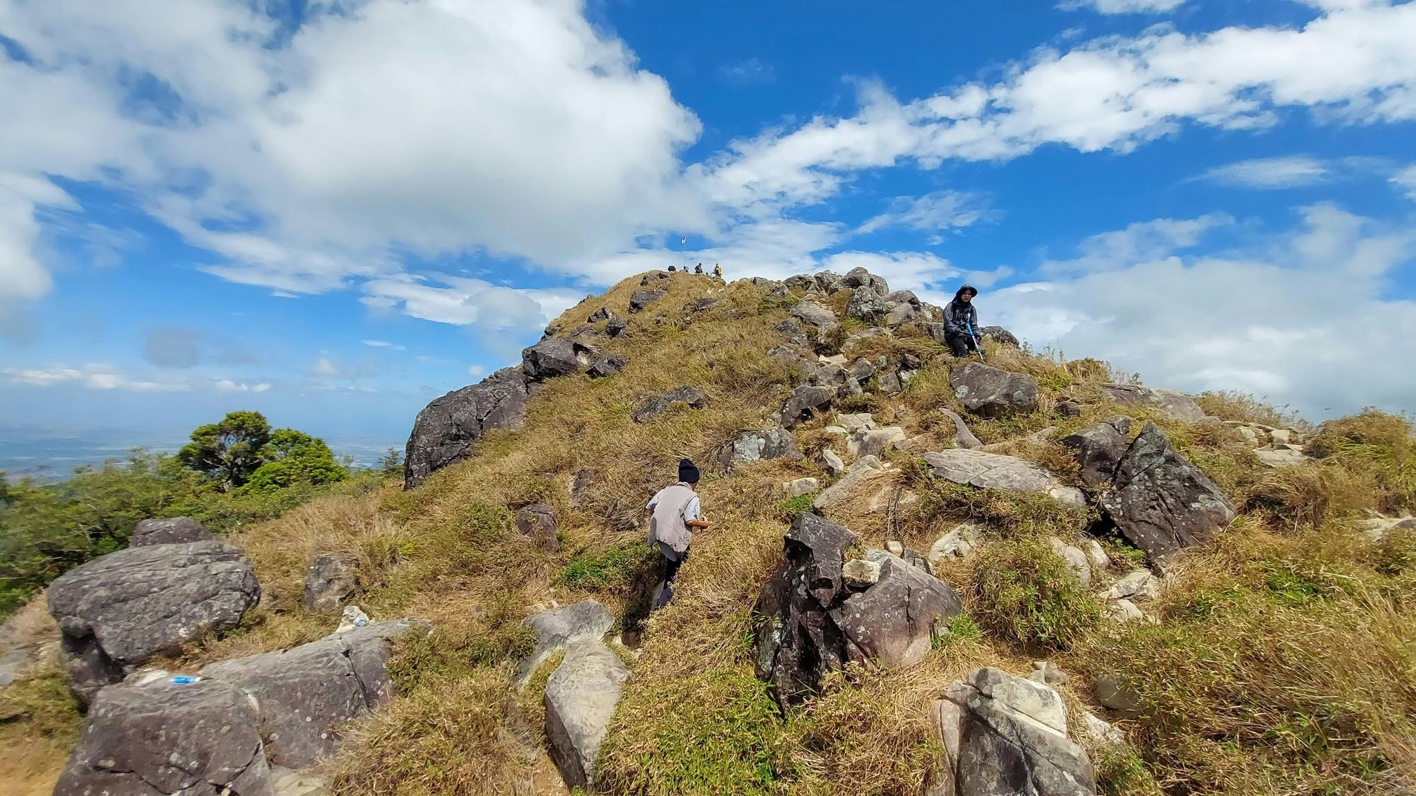
2. Mount Bulusaraung Elevation and Geological Characteristics
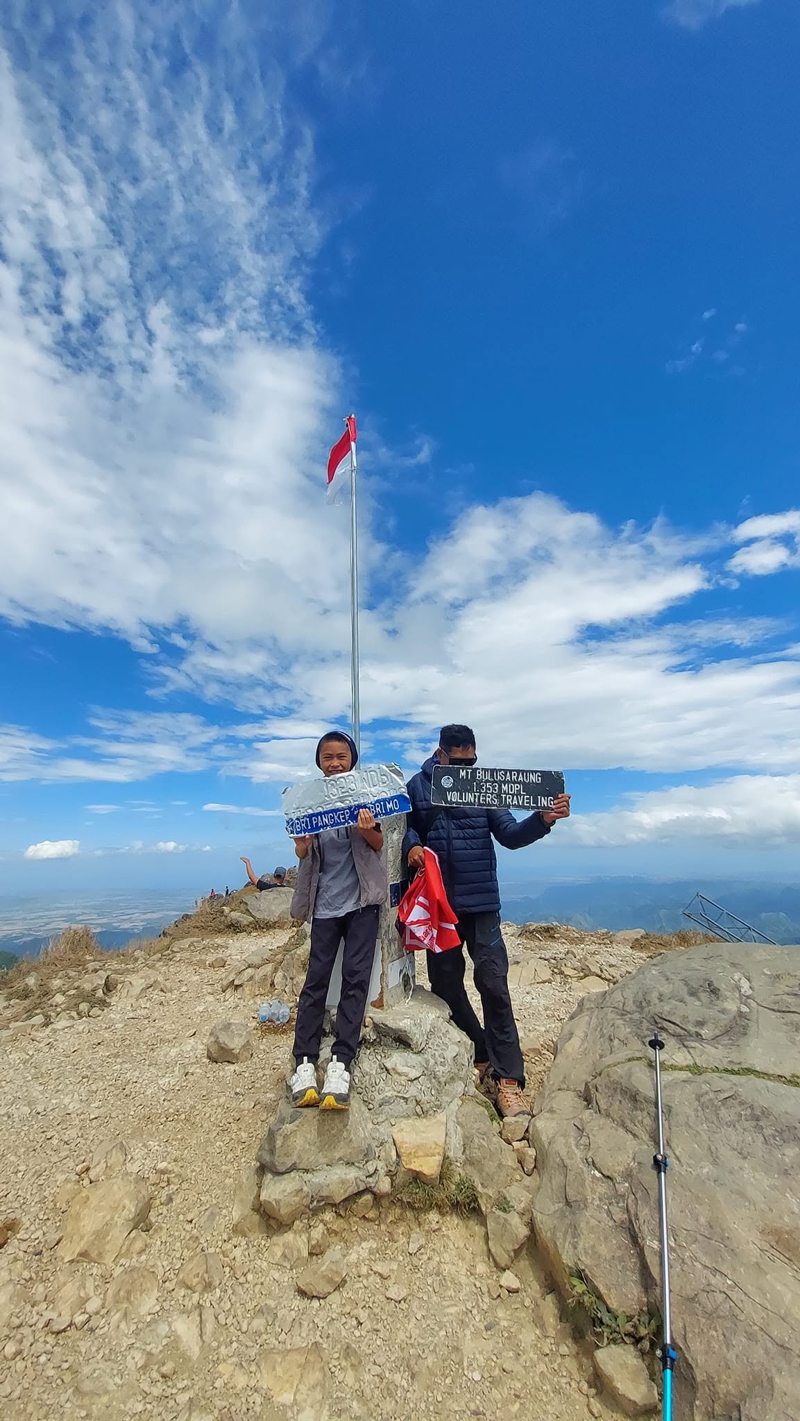
Mount Bulusaraung reaches approximately 1,353 meters above sea level, making it one of the interesting hiking destinations in the Maros-Pangkep region.
One of its most distinctive characteristics is its geological formation. Unlike mountains formed by volcanic activity, Bulusaraung is primarily composed of limestone rocks that developed through geological processes over millions of years.
The mountain belongs to the extensive Maros-Pangkep karst landscape, which features enormous limestone formations, steep cliffs, caves, underground drainage systems, and unique geological structures.
These limestone formations create a distinctive mountain environment. Some sections of the hiking trail pass through rocky terrain, while other sections are surrounded by tropical vegetation.
The combination of limestone geology and forest ecosystems makes Bulusaraung particularly interesting for visitors interested in geology, biodiversity, and nature conservation.
3. Hiking Mount Bulusaraung: Trail and Route Information
Hiking Mount Bulusaraung is a rewarding outdoor experience for visitors who want to explore the natural landscapes of South Sulawesi.
The official hiking route starts from the designated basecamp area near Tompobulu Village. Before beginning the ascent, hikers should complete the necessary registration procedures and follow the applicable national park regulations.
The hiking route consists of approximately nine to ten posts or checkpoints, depending on the trail classification and local management arrangements.
Each section offers different terrain and hiking conditions. Some parts of the trail pass through tropical forest, while others involve steeper slopes and rocky limestone surfaces.
The normal hiking time from the basecamp to the summit is approximately two to three hours for hikers with reasonable physical fitness. However, the actual duration depends on individual walking speed, weather conditions, trail conditions, and the number of breaks.
For beginners, it is advisable to walk slowly and maintain a comfortable pace. Experienced hikers may complete the ascent more quickly, but rushing is not recommended, particularly on steep or slippery sections.
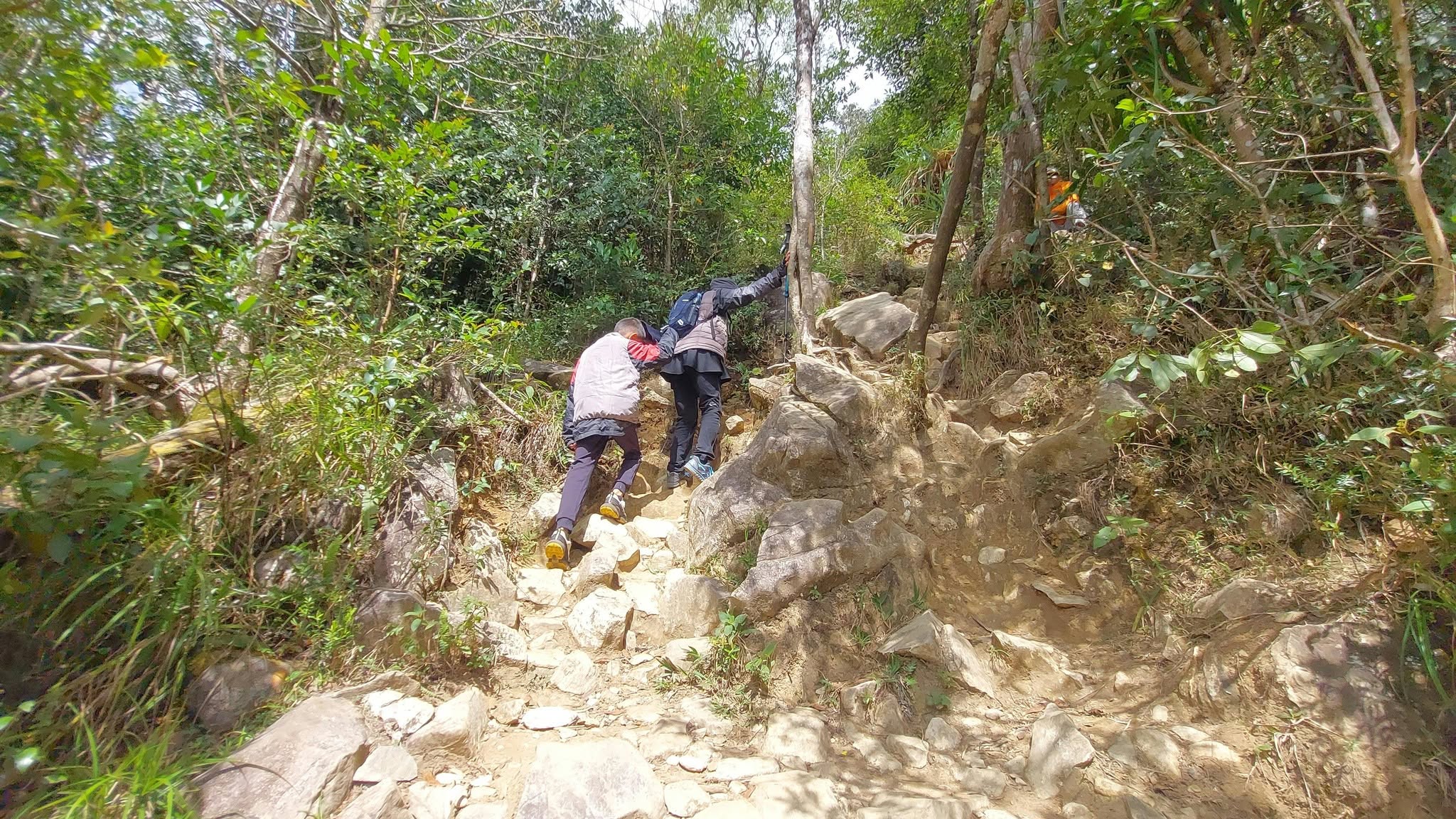
A typical hiking experience includes:
- Registration and preparation at the basecamp.
- Beginning the ascent through forest vegetation.
- Passing several hiking posts and checkpoints.
- Walking through increasingly challenging sections.
- Reaching the summit area.
- Enjoying panoramic views of the surrounding karst mountains.
- Descending carefully to the basecamp.
Hikers should always pay attention to trail markers and avoid taking unofficial shortcuts.
4. The Nine to Ten Hiking Posts of Mount Bulusaraung
One of the interesting features of Mount Bulusaraung is its series of hiking posts along the climbing route.
These posts provide reference points for hikers as they progress toward the summit. They also offer opportunities to take short breaks, drink water, and assess physical conditions.
Although the number of posts is commonly described as approximately nine to ten, their arrangement and condition should be confirmed with local park authorities before hiking.
The lower sections of the route generally involve walking through forested areas with natural vegetation. As hikers gain elevation, the terrain can become more challenging, with steeper slopes and exposed limestone surfaces.
The final sections require extra attention because fatigue can affect balance and concentration.
It is important to remember that reaching the summit is only half of the journey. Descending safely requires just as much energy, concentration, and preparation.
For this reason, hikers should allow sufficient time for the entire trip rather than focusing only on reaching the highest point.
5. Panoramic Views from the Summit
Reaching the summit of Mount Bulusaraung is one of the highlights of the hiking experience.
From the top, hikers can enjoy impressive views of the surrounding Maros-Pangkep karst mountains. The landscape is characterized by numerous limestone hills rising dramatically from the surrounding lowlands.
These formations create a distinctive panorama that is difficult to find elsewhere in Indonesia.
On clear days, the surrounding mountains and valleys become visible across the horizon. The contrast between green tropical vegetation and grey limestone formations creates beautiful scenery for landscape photography.
The summit is also an excellent place to rest, enjoy a snack, and appreciate the natural environment after the challenging ascent.
For photographers, the early morning and late afternoon can offer attractive natural lighting. However, hikers should always consider weather conditions and the available daylight when planning their ascent and descent.
Clouds, mist, and changing weather can influence visibility, so the panoramic views are not guaranteed on every hiking trip.
6. Flora, Fauna, and Natural Biodiversity
Mount Bulusaraung is part of Bantimurung Bulusaraung National Park, an important conservation area in South Sulawesi.
The national park contains diverse ecosystems, including limestone forests, tropical vegetation, caves, and other habitats supporting various plant and animal species.
The surrounding forests provide shelter for birds, insects, reptiles, and other wildlife. Visitors may encounter butterflies, forest birds, and various insects during their journey.
The wider Bantimurung region is particularly famous for its butterfly diversity, which has contributed to its reputation as an important natural tourism destination.
The limestone environment also supports specialized plant communities adapted to rocky surfaces and relatively thin soils.
Hikers should avoid disturbing wildlife, collecting plants, damaging trees, or leaving rubbish along the trail.
Responsible hiking helps preserve the natural environment and ensures that future generations can continue enjoying the beauty of Mount Bulusaraung.
7. Best Time to Hike Mount Bulusaraung
Weather conditions are an important consideration when planning a hiking trip to Mount Bulusaraung.
Generally, the dry season in South Sulawesi offers more favorable conditions for outdoor activities. During periods of lower rainfall, hiking trails are often easier to navigate, and visibility from the summit may be better.
However, tropical weather can change quickly, even during the dry season.
During the rainy season, some sections of the trail may become muddy, slippery, and more difficult to climb. Wet limestone surfaces can be particularly challenging because they may reduce traction.
Before departure, hikers should check the latest weather forecast and confirm whether the hiking route is open.
The best time to start climbing should also be discussed with the local guide or park officers. An early departure is generally preferable because it provides more time to reach the summit and return before darkness.
Avoid continuing toward the summit during thunderstorms, heavy rainfall, or dangerous weather conditions.
8. Essential Equipment for Hiking Mount Bulusaraung
Although Mount Bulusaraung is not among the highest mountains in Indonesia, proper preparation is still necessary.
Its steep sections, rocky terrain, and tropical weather conditions mean that hikers should bring suitable equipment.
Recommended hiking equipment includes:
- Hiking shoes: Wear comfortable shoes with good grip for limestone and potentially slippery trails.
- Daypack: Carry a lightweight backpack for personal belongings and essential supplies.
- Drinking water: Bring sufficient drinking water to maintain hydration throughout the hike.
- Food and snacks: Prepare energy-rich snacks and meals to support your physical activity.
- Rain jacket: Tropical rainfall can occur unexpectedly.
- Headlamp: Useful in case the hike takes longer than expected or darkness approaches.
- First aid kit: Carry basic medical supplies for minor injuries.
- Sun protection: Bring sunscreen, a hat, and sunglasses.
- Personal medication: Bring any necessary medication you may require during the trip.
A hiking pole can also be useful, particularly during the descent, when your knees and legs experience additional pressure.
Avoid carrying unnecessary equipment because a lighter backpack makes the climb more comfortable.
9. Hiking Mount Bulusaraung with a Local Guide
For visitors unfamiliar with the area, hiking with a local guide can make the experience more comfortable and organized.
Local guides understand the surrounding environment, hiking routes, weather patterns, and local customs. They can help visitors navigate the trail, manage hiking schedules, and recognize potentially difficult sections.
For international travelers, an English-speaking guide can also provide information about the geological characteristics, biodiversity, and cultural environment of South Sulawesi.
At Sulawesi Hike, we believe that local knowledge plays an important role in creating meaningful outdoor adventures.
Our hiking services focus on connecting travelers with local mountain leaders and experienced porters who understand the characteristics of South Sulawesi’s mountains.
Whether you are an experienced mountaineer or a traveler looking to discover a new hiking destination, proper guidance and preparation can help create a safer and more enjoyable experience.
Before booking a hiking service, confirm the guide’s experience, transportation arrangements, equipment requirements, and applicable national park procedures.
10. How to Get to Mount Bulusaraung from Makassar
Makassar is the main gateway for travelers visiting Mount Bulusaraung.
Visitors arriving at Sultan Hasanuddin International Airport can arrange private transportation to the mountain area in Pangkep.
The general journey involves traveling from Makassar toward Maros and continuing to Balocci District before reaching Tompobulu Village.
Estimated travel information:
| Information | Details |
|---|---|
| Destination | Mount Bulusaraung |
| Starting point | Makassar City |
| Regency | Pangkajene and Islands |
| Village | Tompobulu |
| District | Balocci |
| Estimated driving time | 2–3 hours |
| Mountain elevation | 1,353 MASL |
| Hiking duration to summit | 2–3 hours |
Travel time may vary depending on traffic, road conditions, and the starting location.
Private transportation is a convenient option for international visitors, families, and small hiking groups because it allows more flexibility when arranging departure and return schedules.
It is advisable to coordinate transportation with your hiking guide before arriving in Tompobulu.
11. Important Hiking Rules and Safety Recommendations
Mount Bulusaraung is located within a protected national park, so visitors must respect conservation regulations and local management procedures.
Before hiking, make sure you complete the required registration and obtain the necessary permission.
Some important recommendations include:
- Follow the official hiking route and trail markers.
- Register at the designated hiking checkpoint.
- Follow instructions from park officers and authorized guides.
- Do not leave rubbish along the mountain trail.
- Avoid damaging plants, trees, and limestone formations.
- Do not disturb or feed wild animals.
- Bring enough drinking water and food.
- Avoid hiking alone if you are unfamiliar with the route.
- Inform your guide about any medical conditions or physical limitations that may affect your hike.
- Turn back if weather or trail conditions become dangerous.
Hikers should also check the latest national park announcements because access restrictions, registration procedures, and operating arrangements may change.
Responsible tourism is essential for protecting the unique karst ecosystem of Bulusaraung.
12. Explore Mount Bulusaraung with Sulawesi Hike
South Sulawesi has many beautiful mountain destinations waiting to be explored, and Mount Bulusaraung is an excellent choice for travelers seeking a combination of adventure, nature, and geological landscapes.
At Sulawesi Hike, we provide hiking information and local trekking services for several mountain destinations across South Sulawesi.
Our destinations include Mount Bawakaraeng, Mount Moncong Lompobattang, Mount Bulubaria, Mount Kappire, Mount Bulusaraung, Lembah Lohe, Lembah Ramma, and other natural attractions.
We connect travelers with local hiking leaders and experienced porters who understand the characteristics of the mountains in this region.
Our goal is to make mountain adventures more accessible to domestic and international travelers while supporting local communities and responsible tourism.
Whether you want to enjoy a one-day hike, explore a limestone mountain, or plan a multi-day trekking expedition, South Sulawesi offers many opportunities for unforgettable outdoor experiences.
Mount Bulusaraung is more than just a mountain to climb. It is an opportunity to discover the extraordinary karst landscapes, tropical biodiversity, and natural beauty of South Sulawesi.
Plan your next adventure with Sulawesi Hike and discover the mountains beyond the ordinary.
Sulawesi Hike – Beyond Trails, Beyond Limits.

Maybe you are interested in reading the following article:
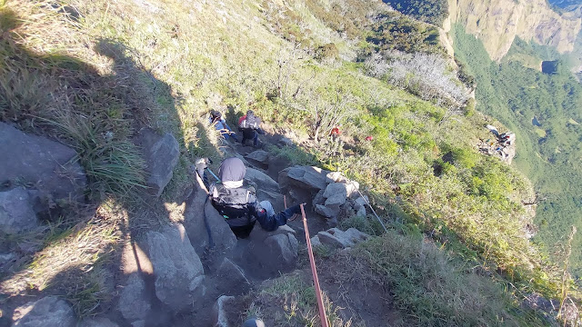
Mount Bulubaria Trekking Guide: Route, Difficulty, Best Time and Mountain Views
If you are looking for a spectacular mountain adventure away from the crowded hiking destinations of Indonesia, Mount Bulubaria trekking is an exciting option to explore in South Sulawesi. Rising to approximately 2,730 MASL, Mount Bulubaria offers a combination of challenging trails, peaceful mountain landscapes, open ridgelines, and expansive views that mak... read more
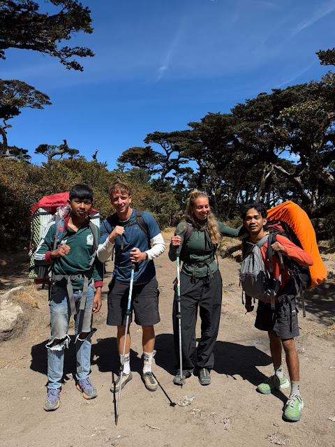
Mount Bawakaraeng Hiking Guide: Trails, Camping, Sunrise and Mountain View
Mount Bawakaraeng is one of the most impressive hiking destinations in South Sulawesi, Indonesia. Rising to approximately 2,830 meters above sea level (MASL), the mountain attracts hikers looking for challenging trails, mountain landscapes, camping experiences, sunrise views, and the spectacular phenomenon known as a sea of clouds. For travelers planning the... read more
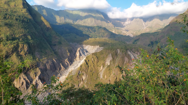
How to Hike Lembah Lohe from Makassar: Complete Guide for First-Time Hikers
If you are looking for a peaceful mountain adventure near Makassar, South Sulawesi, Lembah Lohe is a destination worth adding to your hiking list. Surrounded by green mountains, open grasslands, forests, and beautiful natural landscapes, Lembah Lohe offers a different experience from the more crowded tourist destinations in South Sulawesi. For first-time hik... read more
Contact Us
If you have any questions, please contact us.
-
Hotline
+62881080121080 -
Whatsapp
+62881080121080 -
Email
amiruddinemail@gmail.com


No comment yet